The National Parks, Hiking and Wildlife of Colombia

Introduction
A lot of the national parks, hiking locations and wildlife watching areas are covered in other areas of this guide. This page brings together that information and adds some other areas that we have visited but do not readily fit into other areas of this guide.
When the bradt guide was written (see page books on Colombia for more information) there was 52 designated parks which covered about 8.5% of the country. There are other applications being processed for areas to be promoted to national parks status.
The safety situation in Colombia is slowly improving, this gives visitors the opportunity to explore the fantastic variety of wildlife and countryside. Colombia offers landscapes from the high Andes covered in glaciers down to lush rain forests and caribbean beaches.
 National Park Location  Hiking Location  Wildlife Watching Location |
National parks on this page:
- Igaque Páramo, hiking and sacred Muisca lake.
- Alto Rio Fonce Páramo, hiking and many lakes.
- Chingaza Páramo, hiking and beautiful lakes.
- Cocuy Páramo, Snowy Peaks, hiking and beautiful lakes. The park also includes
- Tayrona Gorgeous Caribbean beaches and tropical dry and rain forest.
- Sierra Nevada de Santa Marta The lost city trek.
- Los Colorados Dry and tropical forest.
- Corales de Rosario Visiting Isla Baru.
- Paramo de Oceta Páramo and interesting canyon.
- Cundinamarca Hiking opportunities around Bogota.
- Mompox A boat trip to see monkeys, iguanas and eagles.
- Bird and Animal Watching Bird and Animal watching in Colombia.
- Further Information Where to find out more information.

Iguaque National Park
This park covers 6,750 hectares high in the mountains of Boyaca. The park contains high andean forest and páramo.
There is one maintained footpath which leads to the Laguna de Iguaque. The Laguna de Iguaque is a sacred musica site. For further information on the trek see the page on Villa de Leyva and Park Iguaque here.
Access to the park is from Villa de Leyva or Tunja. To get to Villa de Leyva take a bus to Tunja and change there. Once in Villa de Leyva you need to take a bus at 7am from the terminal in Villa de Leyva.
National Park Iguaque
National Park Iguaque
Laguna de Iguaque
Further information:
- Villa de Leyva and Parque Iguaque Further details on this website.
- National Parks Website The offical webpage for Iguaque (spanish).

Alto Rio Fonce National Park
Guanentá Alto Rio Fonce covers 10,439 hectares and covers the high mountains on the border of Boyaca and Santander. The park contains the largest Oak forest in Colombia. The park also contains páramo and high andean forest.
There are various locations that the park can be accessed from including Encino, Charalá and Gambita in Santander and Duitama and Sogamoso in Boyaca.
We've only accessed the park from Duitama from where you can follow hiking trails to La Rusia Páramo and Pan de Azucar Páramo. For more information on access the park from Duitama see the page on Duitama and Pan de Azucar here.
Pan de Azucar Páramo
Pan de Azucar Páramo
Laguna de Pan de Azucar and El Morro en the background.
Further information:
- Duitama and Alto Rio Fonce Further details on this website.
- National Parks Website The offical webpage for Alto Rio Fonce (english).

Chingaza National Park
Chingaza covers 76,600 hectares, covers terrain from 800 metres above sea level to over 4,000 metres above sea level. The park contains both tropical forests and paramo. Animals present in the park include spectacled bears, pumas, deer, monkeys and the condor.
The park is very close to Bogota which should make it easy to visit, however there are very few villages near the park so using public transport to access the park is extremely difficult. One exception are the Lagunas de Siecha in the North of the park which are close to Guasca. Walking to these lagunas is covered in the days out from Bogota page here.
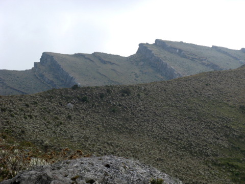
The ridge above Lagunas de Siecha.
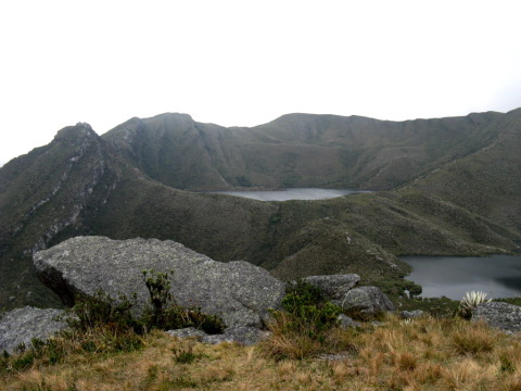
Lagunas de Siecha.
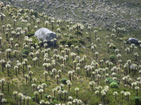
A field of Frailejones.
Further information:
- Photos of Chingaza A website full of photos of Chingaza.
- National Parks Website The offical webpage for Chingaza (spanish).
- National Parks Website The offical webpage for Chingaza (english).
- Colombia Tourism Board The Colombian Tourist Boards page on Chingaza.
- Colombia Portal Tourist information on Chingaza, includes a map of the park
- Parks of Colombia Information on the park including areas to visit.
- Motobike Blog Information on a motobike trip onto Chingaza, includes lots of photos
- Days Out From Bogota A page on this site which covers day hikes from Bogota which includes a hike to Lagunas de Siecha in Chingaza.

The Cocuy National Park
El Cocuy covers 306,000 ha and includes a huge variety of terrain including; glacier covered mountains, super paramo, paramo and sub tropical forests. Just 3% of the national park is covered by the nevados (snowy mountains) however this is one of the main reasons for visiting. The highest point of the park is the summit of Ritacuba Blanca at 5,300 metres.
El Cocuy covers a huge area in the North of Boyaca and Casanare. The usual access point for the nevados is either Guican or El Cocuy, both villages in Northern Boyaca. The bus to Guican takes 10 hours from Bogota.
To access the park you must take a guide (solo hiking/treking is not allowed). There are no onsite facilities thus all equipment must be carried into the park - including lots of warm clothes because it gets very very cold at night.
There are various treks within the park including the round Cocuy trip which takes 6 days and involves circumnavigating the nevados. Popular summits to reach include the Concavo (5,200 metres), Concavito (5050 metres) and Pan de Azucar (5,150 metres) which are all easy glacier walks.
The glaciers of Colombia are fasted receding glaciers in the world.
Pan de Azucar.
Concavo (centre of glacier) and Concavito (far left of glacier).
Map of the Nevados in El Cocuy.
Further information:
- Photos of Cocuy Photos from our trip to Cocuy where we climbed Concavo and Concavito.
- National Parks Website The offical webpage for El Cocuy (spanish).
- De Una English speaking tour company based in Bogota who can organise trips to El Cocuy.
- Guaicani We went to El Cocuy with Victor the owner of Guaicani.
- Travel Blog Entry from a blogger about their hiking in the park.

Tayrona National Park
Tayrona is just 34km from Santa Marta and follows a stretch of Caribbean Coast. The park contains both dry and rain forest. There are over 100 species of mammal in the park along with a huge amount of bird life.
There is accomodation in the park, you can either stay in expensive posh cabins, camp or stay in a hammock. There are two hammock places in the main area of the park; Cabo San Juan and Arrecifes.
Arrecifes is the easiest to reach but you cannot swim on the beach there, you have to walk to Piscina. At Cabo San Juan you can swim, the beaches are also a lot prettier here.
There is an old indigenous village in Park Tayrona called Pueblito, the inhabitants were wiped out by the Spanish. The village is a 60 minute walk from Cabo San Juan. The walk goes steeply up hill following the old trading path. Their is an alternative footpath from behind the nudist beach that takes about 2 hours.
To get to Tayrona you need to take a bus from Santa Marta, the bus takes about 60 minutes and is very cheap. The bus leaves from the corner of Calle 11 and Carrera 11 in Santa Marta.
The bus should drop you off at the park entrance near Restaurante Donde Anita. Here you will probably be searched by the police and then have to pay your entrance into the park. Once inside the park you will be able to get a 10 minute bus ride to the car park (2000COP).
From the car park it is a 60 minute walk to Arrecifes. From Arrecifes it is a 45 minute walk to Cabo San Juan.
Google Earth users can download this file which has pins in the important places of Tayrona. You can also see this map in Google Earth.
Beach in Park Tayrona.
Beach in Park Tayrona.
Lizard in Park Tayrona.
Spider Monkey in Park Tayrona.
Further information:
- National Parks Website The offical webpage for Tayrona (spanish).
- Google Earth Download this file to view the different locations in Tayrona.
- Travel Guide The Poor But Happy Travel Guide to Tayrona.
- Travel Guide Hostel Trail Travel Guide to Tayrona

Sierra Nevada De Santa Marta: The Lost City Trek
The Sierra Nevada contains the highest two mountains in Colombia. The park has over 628 different bird species (more than in the USA and Canada combined) of which 70 are endemic to the park.
There are currently two treks to Ciudad Perdida (The Lost City), one takes five days and the other takes 6 days. There are more routes planned in the future. You must hire a guide to visit The Lost City and the guides usually go with groups of 6 or more. There are various companies offering treks to The Lost City, we went with Turcol. Turcol are the original company and still own the accomodation on route to The Lost City (and thus get priority use of it). We were very impressed with Turcol.
The Lost City was inhabited by the Tayrona people, the decedents of these people, the Kogi, still live in the area. You will pass several Kogi settlements on the way to the Lost City. The Kogi people do not like people visiting The Lost City, nor people photographing them or their villages.
An easy river crossing on the way to Ciudad Perdida.
A brief view out of the Jungle.
Approaching the 12,000 steps that lead to the Lost City.
Looking over The Lost City.
Further information:
- National Parks Website The offical webpage for the Sierra Nevada de Santa Marta (spanish).
- Turcol The main company for visiting the Lost City.
- The Lost City Trek A page about Turcol and the Lost City Trek from Hostel Trail.
- The Heart of the World A documentary produced by the BBC about the Kogi people - free to watch at google videos. The film covers the Kogi's believes and the history of The Lost City.
- Google Earth Download this file to view the different locations along The Lost City Trek.
- Google Map The above map shown in Google Maps

Los Colorados National Park
Los Colorados covers 1,000 hectares, it is just 230 metres above sea level. It is made up of dry and tropical forest, it has around 288 bird species and 44 species of mammals.
The park is halfway between Sincelejo and Cartegena near the town of San Juan de Nepomuceno, in the department of Bolivar.
There are no tourist facilities on site. The administration office for the park is in San Juan de Nepomuceno. You need to visit the office to pay the entrance fee, the cost includes a guide. You and your guide will be driven the 10 minutes to the park. There are two walks that can be done with your guide, one takes 5 hours and the other takes 3 hours. The entrance fee is 7,000COP for Colombians and 20,000COP for foriegners. Take your swimming gear!
The park adminstration is on carrera 10 and between calle 9 and calle 10.
We stayed at Hospedaje Carmen, Carrera 9 #11-23 (telephone 689 0095, cellular 312 62859). We paid 35,000COP per night for a room with a/c. The hotel was very clean and modern.
The park is meant to be best during the wet season between September and December. This is the period when most plants are in flower. Early morning and late evening are meant to be the best times to visit when there are more birds around. The worst time to visit is between March and June which is the dry season because all of the trees lose their leaves.
View over Los Colorados National Park.
River flowing through Los Colorados.
Flower in Los Colorados.
Further information:
- National Parks Website The offical webpage for Los Colorados National Park (spanish).
- Wikipedia A reasonable entry on the park along with the flora and fauna that you might see.
- Park Information Information on the park from the San Juan de Nepomunceno town website.
- San Juan Tourist Directory Tourist directory from the San Juan de Nepomunceno town website.
- Google Earth Download this file to view the different locations for Los Colorados.
- Google Maps The above map shown in Google Maps.

Corales de Rosario National Park: Isla Baru
National Park Corales de Rosario covers 120,000 hectares, the park is 45km from Cartegena Bay. The park covers several coral reafs.
The easiest area to access of the park is Isla Baru. There are tour boats that visit other areas of the park but the tour boats are huge and you'll be travelling with several hundred other tourists. A lot of the islands are privately owned and in can be very expensive to visit. Isla Baru is cheap to get to and cheap to stay on.
There is good snorkling from Playa Blanca on Isla Baru. The best time to visit Playa Blanca is during the week and away from holiday periods. Snorkling gear can be hired on Playa Blanca.
You can reach Isla Baru using two methods. You can go on a large tour boat, which is the slowest method. The alternative method is to go to the Bazurto Market and catch a speed boat (between 15,000 and 25,000COP).
Once on Playa Blanca on Isla Baru there are a variety of hammock and camping places to choose from. We stayed at D & E Hammocks which we were very impressed with. The hammock place is run by two brothers Edgar and Diego (Edgar speaks excellent English). Both brothers are very friendly and were very helpful with getting us to and from Playa Blanca. We paid 8,000COP per night for a hammock and 10,000COP for a huge plate of fish. You can ring Diego on 311 592 6246 and Edgar on 301 679 7164.
Playa Blanca on Isla Baru.
Playa Blanca on Isla Baru.
Further information:
- D & E Details A poor but happy post including information on the hammocks.
- National Parks Website The offical website for the national park.
- Google Earth Locations for visiting Isla Baru.
- Google Maps The above map shown in Google Maps.

Páramo de Oceta
Páramo de Oceta is a beautiful páramo in Boyaca, it is above the village of Mongui. Mongui can be easily reached from Sogamoso.
The páramo includes Ciudad de Piedras, a canyon which is famous for it's plantlife. There is an excellent hike that starts at the village of Mongui and reaches just under 4,000 metres. Sogamoso, Mongui and Páramo de Oceta are covered on this page.
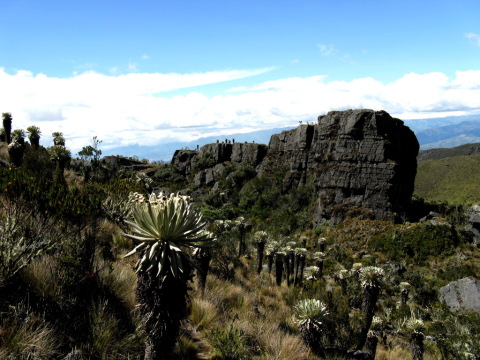
Ciudad de Piedras.
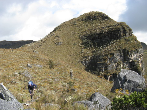
Summit of Páramo de Oceta.

Cundinamarca
There are lots of walking/hiking opportunities within Cundinamarca. This provides good quality days out from Bogota. There are various ecosystems around Bogota including cloud forest, páramo and marsh land.
The Muisca people lived in the area now covered by Cundinamarca and Boyaca, there are various important sacred sites within Cundinamarca. Sites include Laguna de Guatavita, Laguna de Siecha, Piedas del Tunjo and Majuy Hill.
This page covers these areas and others for hiking and exploring around Bogota.
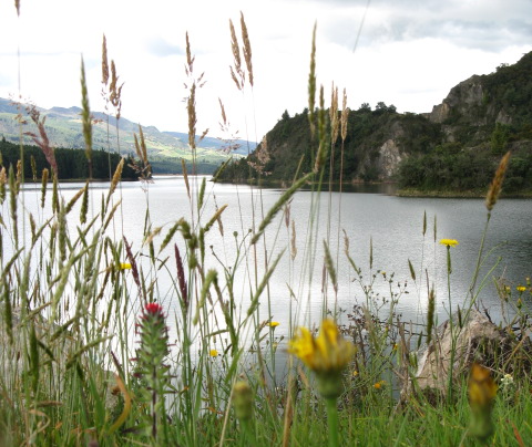
Reservoir Neusa.

Chicaque - Cloud Forest.

Parque Verjon - Paramo above Bogota.

Mompox: Boat Trip
Mompox is on the banks of the Magdalena River (the major river of Colombia). Mompox was made a UNESCO World Heritage Site in 1995. Mompox used to be a stopping place for boats on the way between the coastal port at Baranquilla and Bogota. When steamboats were introduced they used a larger branch of the river and Mompox lost its importance.
Now Mompox is a sleepy city where sitting in rocking chairs and watching the Magdalena go by is the main entertainment.
For wildlife watching Mompox is excellent. There is a daily boat trip that visits a large lake (Cienaga del Pijiño) that is accessed from the Magdalena. On this boat trip it is possible to see monkeys and iguanas. There is also a huge amount of birdlife to see including snail kites and eagles. The boat trip costs 30,000COP per person.
The organisers of the boat tour go around all of the hotels in Mompox between 1pm and 2pm collecting people to join them. The boat tour leaves about 2.30pm from Mompox and returns at about 6.30pm.
Reaching Mompox is a little tricky at the moment, however the planned new road will make things easier. If your going by public transport the best method is to get a bus to Magangue from Cartagena or Sincelejo. From Magangue you can get a river speed boat to Bodega (6000COP). From Bodega catch a taxi which will take you for 5 minutes to a bridge which is currently being rebuilt (2000 COP), a small boat will take you across the river while the bridge is being rebuilt (1000COP). You then need to catch another taxi that will take you all the way to Mompox.
There are plenty of hotels in Mompox and it should always be possible to get a room.
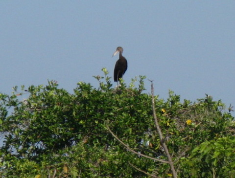
A Little Blue Heron - Mompox.
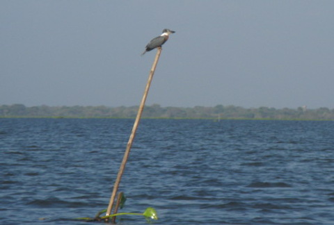
Ringed Kingfiser - Mompox.
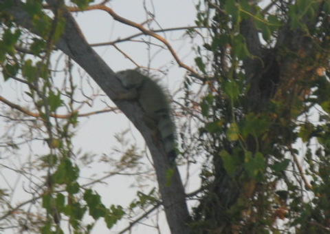
Iguana - Mompox.
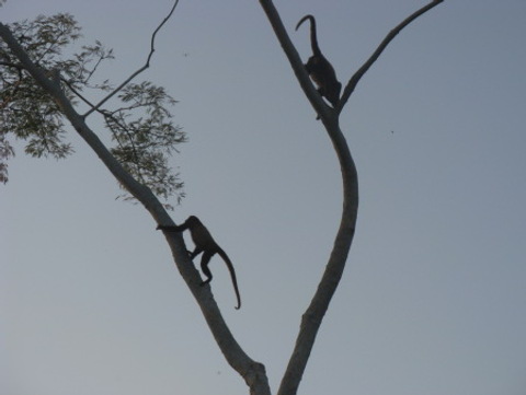
Howler Monkeys - Mompox.
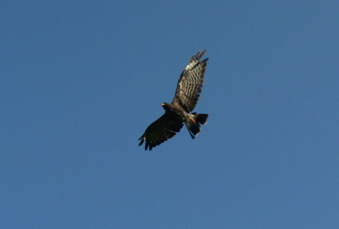
Snail Kite - Mompox.
Further Information:
- Mompox Travel Guide Poor But Happy Travel Guide to Mompox.
- Cienaga del Pijiño Boat Trip Poor But Happy Guide to this Boat Trip
- Hostel Guide Hostel Trail Travel Guide to Mompox
- Google Earth Locations for arriving to Mompox.
- Google Maps The above map in Google Maps.

Bird and Animal Watching in Colombia
Colombia is the second most biodiverse country in the world (after Brazil). Some 20% of all of the worlds bird species are represented in Colombia (making it the most biodiverse country in the world for bird life).
Although Colombia can't offer the same large mammals as Africa there are a huge number of interesting species here to observe. Speckled bears, jaguars and tapirs are present in the mountainous parks. A variety of monkeys can be found in the warmer parks. Capybaras and armidillos can be found in the wetter parks. In the rivers there are pink dolphins, the Orinoco turtle and giant river otters.
For bird watching the best organisation is Proaves. They are a charity dedicated to preserving important bird habitats. They maintain several reserves within Colombia. There website is www.proaves.org.
There is an excellent book on the birds of Colombia. You can find out details on the page on Colombian books.
Websites for Bird Watching:
- Fat Birder Information and details of bird watching in Colombia.
- Bird Watching Safely in Colombia Another website covering areas to go bird watching in Colombia.
- Proaves Charity maintaining bird habits with reserves that can be visited.
Websites for Mammal Watching:
- MammalWatching.com Page on mammal watching in Colombia (covers areas to watch wildlife and what you can see).
- Matt Miller's Report Some notes based on Matt Millers research visit to Colombia.
Howler Monkey - Near Mompos.
Magnificant Frigate Bird - Taganga.
Parakeet - Tayrona.
Black Vultures - Villa de Leyva.

Further Information
Finding information on visiting the national parks can be very difficult. The main parks office is on carrera 10 #20-30, Bogota. The people working here though tend not to be very knowledgeable. The national parks website is www.parquesnacionales.gov.co which has some useful information for some of the parks.
Websites:
- National Parks Website The offical site for the national parks in Colombia.
- Colombia Tourist Board General information for tourists which includes some info on the parks.
- Colparques A website covering the various parks.
Other information:
- .
- Mountain List A list of mountains and their locations and heights in Colombia.
- Camping Gear Shops A list of camping gear shops in Bogota from Poor but Happy.
Hiking Clubs: Most hiking in Colombia is done is large groups within a club. Here are some links to some of the Bogota based clubs:
top© James Richardson 2008, Contact, Home, Back to Colombia Travel Guide